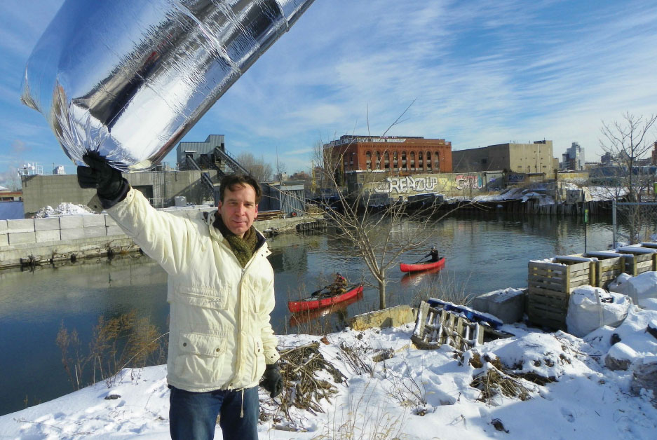
The Grassroots Mapping project began in the summer of 2010 when a group of activists, educators, and technologists known as the Public Laboratory for Open Technology and Science (PLOTS) began documenting the BP oil spill on the American Gulf Coast using balloon mapping – an accessible and low-cost alternative to satellite imaging. Recognizing the power of “community satellites†to subvert the power dynamics associated with cartography, the project has since expanded to nine environmentally compromised sites across the country. Their website GrassrootsMapping.org includes how-to instructions for balloon and kite mapping as well as other low-cost DIY environmental sensing devices. Awarded a $500,000 grant last year by Knight News, PLOTS is expanding its work to support community action through locally produced environmental and civic data.
- Projects
- 61st Street Farmers Market
- 78th Street Play Street
- 596 Acres
- 1415
- ACTIVATE!
- Air Quality Egg
- AirCasting
- Amphibious Architecture
- Aquaponics Container System
- Art in Odd Places
- ARTfarm
- Astoria Scum River Bridge
- Bartering and Sharing Networks
- Bat Cloud
- Bench Press
- Better Block
- BK Farmyards
- Brooklyn Night Bazaar
- Bubbleware
- Building Projections
- Bunchy Carter Park for the People
- By the City/For the City
- Campito
- Cart Coop
- chainlinkGREEN
- Chair-bombing
- Chicago Rarities Orchard Project
- City Farm
- The City from the Valley
- City Sensing: Signal Spaces
- Cleveland Bridge Project
- Come Out & Play Festival
- Community Living Room
- Crown Heights Participatory Urbanism
- Cut.Join.Play.
- Day Labor Station
- Depave
- Dérive App
- Detroit, Demolition, Disneyland
- Dream It. Grow It.
- Eco-Playground
- Edible Estates
- Edible Schoolyard
- Edible Wall
- Faubourg St. Roch Project
- Field Guide to Phytoremediation
- Flint Public Art Project
- For Squat / Reuben Kincaid Realty
- Fresh Moves Mobile Market
- Ghost Bikes
- GOOD Ideas for Cities
- Grassroots Mapping
- Greenaid Seedbomb Vending Machine
- Guerrilla Bike Lanes
- Guerrilla Drive-Ins
- Guerrilla Gardening
- Guerrilla Grafters
- Harvest Dome
- Holding Pattern
- Hypothetical Development Organization
- I Wish This Was
- ICE-POPS
- Iluminacción
- Imagination Playground
- Imaging Detroit
- Insert____Here
- Intersection Repair
- Islands of LA
- Kingshighway Skatepark
- KISS Popup Chapel
- LA Green Grounds
- Legal Waiting Zone
- LentSpace
- LightLane
- Linden Living Alley
- Local Code: Real Estates
- Local Previews
- Making Policy Public
- Marcus Prize Pavilion
- Mobile Dumpster Pools
- Moving Design: Civic Intervention
- Museum of the Phantom City
- MyBlockNYC
- Neighborland
- New Public Sites
- NY Street Advertising Takeover
- No Longer Empty
- Notes for Anyone
- Occupy Wall Street
- OpenPlans
- Paintings for Satellites
- Parking Plot
- Parklets
- Parkman Triangle Park
- Parkmobiles
- Participation Park
- People Make Parks
- Periscope Project
- Phone Booth Book Share
- PHS Pops-Up Garden
- Piazza Gratissima
- Pixelator
- Place It!
- Place Pulse
- Placemaking in Bronzeville
- Pop Up City
- Pop Up Lunch
- Pop-Up Art Loop
- Popularise: Build Your City
- popuphood
- Post Furniture
- Power Cart
- Power House
- proxy
- PUPstop Project
- QR_Hobo_Codes
- Queens Boulevard Intervention
- re:NEWS
- Red Swing Project
- San Francisco Garden Registry
- SeeClickFix
- Serendipitor
- Skipping Only Zones
- Soil Kitchen
- Spatial ConTXTs
- Stairway Stories
- Streetfilms
- Syracuse Downtown
- Tactical Urbanism Handbook
- TrafficCOM
- Ten New Historical Markers
- TERRITORY
- TreeKIT
- Trees, Cabs and Crime in San Francisco
- The Uni
- Version Festival 12
- Visionary Chicago
- Walk Raleigh: Guerrilla Wayfinding
- War Gastronomy: Recipes of Relocation
- #whOWNSpace
- Yarnbombing
- Teams
Public Laboratory
Grassroots Mapping
National
2010 to present
Community, Information, Sustainability
Varies
2-5 hours average per mapping session
300 actively conducting aerial imagery
Problem - lack of information about environmentally contentious sites
Solution - accessible, low-cost mapping and open-source data sharing
